Almost half the objections to the public consultation on Europa’s plans mentioned the impact on local landscapes. The concern was the third most raised concern, according to DrillorDrop analysis.

The proposed drilling site is within the North Yorkshire and Cleveland Heritage Coast and 800m from the edge of the North York Moors National Park and the coastal site of special scientific interest (SSSI). Equipment on the site would also be visible from the Cleveland Way, a long-distance footpath along the cliffs.
Europa said in its application that the proposed development would not be “incongruous” with the buildings currently near the site that are used by local businesses.
But many responses feared the well site, if permitted, would threaten landscapes, industrialise the area and damage the local tourism industry
One said:
“an industrial site so close to the beautiful coastline and caravan park will undoubtedly deter visitors from the area.”
Another said:
“Once damaged, this landscape cannot be restored.”
One response said:
“This development will irrevocably transform an area of outstanding natural beauty into an industrial landscape.”
One response quoted North Yorkshire Council’s description of the county’s ‘spectacular landscapes from the Yorkshire Dales to the North York Moors to our stunning coastline.’ The response said: “This planning application should not be based on profit for the few, i.e. investors, to the detriment of the environment and future generations.”
Another said:
“It will be a blot on the landscape for miles around.”
Another said:
“The proposed industrial development of such a beautiful area is an ugly proposal. Precious, beautiful, valuable land will be destroyed.”
Another said:
“The site will be highly visible to large numbers of local residents and visitors using the Cleveland Way, the old railway cinder track and surrounding footpaths, ruining the landscape on the North Yorkshire and Cleveland Heritage Coast and local business, who rely heavily on tourism to remain in operation.”
Europa is proposing to use a drilling rig up to 38m high, plus a 40m+ crane, a possible coiled tubing tower (12m high), workover rigs (around 25m high), a shrouded ground flare and 2.5m security fencing.
One response said:
“The height of the rig will prove to be a blot on the landscape which will affect tourist numbers and the enjoyment of the local area by the people of Scarborough.”
CPRE North and East Yorkshire (CPRENEY) said:
“the visual intrusion and industrial activity associated with the wellsite would detract from the scenic quality and tranquillity of these protected landscapes, contrary to the objectives of conserving the natural environment and as such contrary to both national and local planning policies.” [see below]
Newby and Scalby Town Council said:
“The 38m high drilling rig would perhaps be the aspect of the development most visually intrusive in the landscape. For comparison, this would be half as tall again as Scarborough Castle keep and twice the height of Scarborough Pier lighthouse. It would undoubtedly dominate the landscape and the village and spoil the views from the Coastal Path, the Cinder Track and the National Park.”
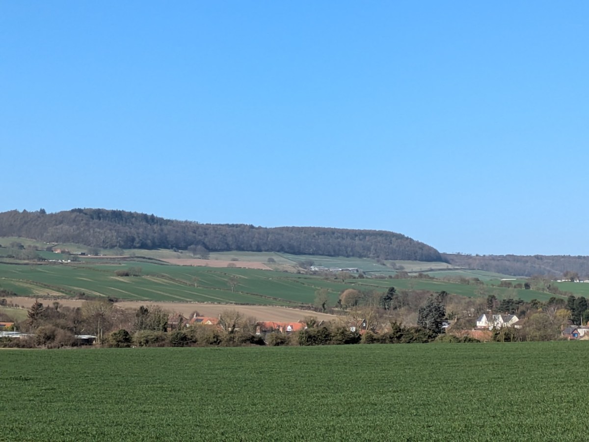
Photo: DrillOrDrop.com
What the policies say?
North Yorkshire minerals plan
Several responses said the development contravened the North Yorkshire’s minerals plan [see also our article on responses about fracking and proppant squeeze].
Heritage coast
The minerals plan protects the Heritage Coast. It states: ‘Permission will only be granted where it would not lead to an unacceptable impact on the historic character and setting of York or on the undeveloped character of the Heritage Coast, unless the need for, or benefits of, the development outweigh the harm caused.’ [Policy D06]
One response said:
“this is an attractive coastal area where the steep cliffs and rocky coves abut undulating farmland. The coastal footpath offers dramatic views of the rugged coastline, along with contrasting views over a rolling rural landscape towards a backdrop of wooded hills within the National Park. The quality and variety of this landscape give the area considerable scenic value. …
“The application to explore for gas from the Mill Yard site is entirely inappropriate large-scale industrial process that would lead to an unacceptable impact on the undeveloped character of the Heritage Coast and the application should be refused.”
Friends of the Earth said:
“We believe the potential for a significant effect in both landscape and visual terms equates to ‘unacceptable impact’ on the undeveloped character of the wider area and users of sensitive National Trails – with neither the limited need for this gas or short-term economic benefits arising from the scheme outweighing such concerns.”
National Park
The site is also within the plan’s 3.5km visual sensitivity zone for the national park. (See more in our article on responses about fracking)
CPRENEY said:
“This means that the MPA must give substantial weight to the protection of the National Park by carefully considering proposed developments within its important setting.”
Local amenity
The minerals plan permits development “where it can be demonstrated that there will be no unacceptable impacts on the amenity of local communities and residents, local businesses and users of the public rights of way network and public open space, including as a result of … visual intrusion, … (and) the effect of the development on opportunities for enjoyment and understanding of the special qualities of the National Park” [Policy D02 and M17(3)]
Newby and Scalby Town Council said:
“The open, grassy field would be replaced by a hard-surfaced, industrial compound. This does not indicate to the Town Council a ‘high standard of protection’ for the environmental or recreational assets of the area, nor does it demonstrate that there would be no unacceptable impacts on the amenity of local communities and residents. Where is the ‘very high level of protection’ for the landscape within the National Park visual sensitivity zone?”
National policy
“Strengthened duty”
The Levelling Up and Regeneration Act 2023 (LURA) places a strengthened duty on decision-makers for protected landscapes. In this case, the mineral planning authority must give substantial weight to the protection of the National Park by considering proposed developments within its setting.
CPRENEY said:
“the proposal at this location is not supported by the strengthened duty of the LURA as it simply will not further the purposes of the designation.”
Landscape and rural protection
Several responses stated that the Burniston plans do not comply with the National Planning Policy Framework (NPPF), which shapes planning decisions across England.
Paragraphs 88 and 89 seek to “support a prosperous rural economy. One response said:
“We are concerned that the proposal to create ‘the largest onshore gas field in the UK’ along the Heritage Coastline and very close to the National Park is hardly an attractive strapline for the area, and is at odds with items 88 and 89 of the NPPF.
Paragraph 187 says decisions should contribute to and enhance the natural and local environment. This includes by:
- Protecting and enhancing valued landscapes
- Recognising the intrinsic character and beauty of the countryside, and the wider benefits of natural capital and ecosystems
- Maintaining the character of the undeveloped coast
- Preventing new and existing development from contributing to unacceptable levels of soil, air, water or noise pollution
One response said:
“The proposed development will clearly not make a positive, or even neutral, contribution to this sensitive natural landscape. Its presence will only be a negative one, in terms of the potential risks it poses to the ecology above ground and the below ground geology of the area.”
The response said Europa’s plans were “entirely at odds” with paragraph 187. A member of Frack Free Coastal Communities also said this paragraph had “particular relevance” to the Burniston application.
Paragraph 189, highlighted by CPRENEY, states that development within the setting of national parks ‘should be sensitively located and designed to avoid or minimise adverse impacts on the designated areas’.
Another response on this paragraph said:
“The proposed drilling towers, located approximately 800 meters from the North York Moors National Park boundary, represent a substantial visual intrusion, significantly detracting from the area’s protected landscape and scenic character. This directly conflicts with the protective landscape provisions established under this framework, negatively impacting tourism-dependent local businesses.”
Paragraph 191 states: ‘Major development within a Heritage Coast is unlikely to be appropriate, unless it is compatible with its special character’ .
CPRENEY said:
“A proposed hydrocarbon extraction site is considered to be a major development which would be completely incongruous with the special character of the Heritage Coast. Both the National Park and the Heritage Coast are areas of exceptional natural beauty and ecological significance.”
Paragraph 193b states: ‘development on land within or outside a SSSI, and which is likely to have an adverse effect on it, (either individually or in combination with other developments) should not normally be permitted’.
The Burniston site is 800m from the SSSI, which runs from Iron Scar and Hundale Point to Scalby Ness. CPRENEY said the Burniston proposal did not qualify as an exception under NPPF paragraph 193.
Questions over landscape assessment
Friends of the Earth disputed the validity of the application’s Landscape and Visual Impact Assessment (LVIA).
Europa consultants accepted there would be moderate adverse effects on landscape across all phases of the development. But they concluded this would be “not significant” in terms of the overall impact on the environment because it was temporary, short-term and reversible.
Friends of the Earth said no suitable mitigation was likely to offset the views of the rig, nor the impact of “intrusive” 24 hour lighting during drilling and proppant squeeze stages on the dark skies associated with the national park.
Tourism
Around 40% of objections mentioned the risk to the local tourism industry, particularly from damage to the landscape.
One comment said:
One response quoted analysis by the former North Yorkshire County Council, which found that tourism accounted for about 11% of the overall economy and 14% of all employment. The county was ranked fifth in the top tourist destinations in England.
“tourism is important and anything that endangers it must, at all costs, be avoided. … The risks to the local tourist industry of large-scale industrial development on the Heritage Coast are unknown and have not been either recognised or addressed in the Europa application. The risks to the local economy are potentially high and the precautionary principle should apply and the application should be refused.”
Another response said:
“[the drilling site could] deter visitors and reduce the economic contribution that tourism makes to places such as Burniston, Scalby, Cloughton and the surrounding area. The site will be highly visible to large numbers of local residents and visitors using the Cleveland Way, the old railway cinder track and surrounding footpaths, ruining the landscape on the North Yorkshire and Cleveland Heritage Coast and local business, who rely heavily on tourism to remain in operation.”
Another response said further drilling sites that could follow if Burniston were successful would “irrevocably damage the heritage coastline, Cleveland Way, and our natural surroundings, which are not only vital for the environment but are central to our region’s identity and tourism economy”.
Other articles about responses to the consultation
Proppant squeeze/fracturing and induced seismicity

