Back to Lincolnshire map
Please let us know if any of the information is missing or wrong Contact
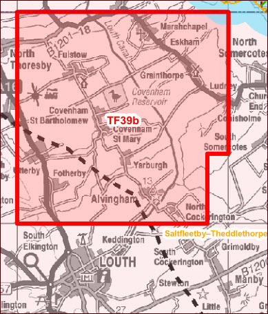

Map credit: DECC Habitats Regulations Assessments of 14th Onshore Oil and Gas Licencing Round
(Maps are in the Appendix E link at the bottom of the DECC page)
TF39b is part of PEDL334
Licence Operator Egdon
Partner CELTIQUE ENERGIE PETROLEUM LIMITED, EGDON RESOURCES UK LIMITED, PETRICHOR ENERGY UK LIMITED
Other blocks in licence TA30
Licence type Shale
Commitments One well, new 2D and 3D seismic surveying
Drill Or Drop clause None
The licence in this area covers several blocks, including this one. The listed commitments are for the whole licence area, not per block.
Administrative areas covered by licence
Lincolnshire
Parliamentary constituencies and MPs
Louth and Horncastle Victoria Atkins Conservative
European areas overlapping with licence block No records
European areas outside block which could be adversely affected
Humber Estuary SAC
Humber Estuary SPA
Humber Estuary RAMSAR
Saltfleetby – Theddlethorpe Dunes and Gibraltar Point SAC
Sensitivity concerns Birds, Coastal habitat, Vibration effects from nearby drilling
Conditions
No conditions proposed.
Advice
This block has European sites within it, or within 1km of the block boundary. In general, land within approximately 1km of a European site is considered to be of a potentially sensitive nature (due to its proximity to the European site) such thatmitigation and/or alternative siting may be required by authorities further considering HRA issues for specific project-level operations. .- In some instances, bird species that are associated with SPAs and some Ramsar sites may rely on non-designated habitats beyond the European site boundaries, and so could be vulnerable to activities occurring outside the designated siteitself. Land within 10km of an SPA, or a Ramsar site designated for its bird populations, is therefore considered to be of a potentially sensitive nature (due to its proximity to the European site) such that mitigation and/or alternative siting may berequired by authorities further considering HRA issues for specific project-level operations. The European sites potentially vulnerable in or near this block are Humber Estuary Ramsar, Humber Estuary SPA.- Coastal or marine habitat features could be vulnerable to any changes in coastal processes that occur due to activities occurring along the coastline. Land located along the coastline (i.e. within 1km of the mean low water level), and which isalso within 10km of a European site with coastal habitats, is therefore considered to be of a potentially sensitive nature (due to its potential connectivity to a European site) such that mitigation and/or alternative siting may be required byauthorities further considering HRA issues for specific project-level operations. The European sites potentially vulnerable in or near this block are Humber Estuary Ramsar, Humber Estuary SAC, Saltfleetby–Theddlethorpe Dunes and GibraltarPoint SAC.- Some of European site interest features (e.g. birds species; fish; marine mammals) are potentially sensitive to noise or vibration effects associated with Stage A activities (as well as Stage B, C and D activities). Land within approximately 1kmof a European site supporting noise or vibration sensitive features is considered to be of a potentially sensitive nature (due to its proximity to the European site) such that mitigation and/or alternative siting may be required by authorities further considering HRA issues for specific project-level operations. The European sites with features potentially vulnerable to this in or near this block are Humber Estuary Ramsar, Humber Estuary SPA, Humber Estuary SAC.


1 reply »