
Live updates from the final full day of evidence at the public inquiry into plans by Egdon Resources to produce oil from its site at Wressle in Lincolnshire.
Today’s session is expected to hear more evidence from Egdon consultant James Dodds and from the company’s planning witness, Paul Foster.
Egdon is appealing against refusals of planning permission by North Lincolnshire Council in January and July 2017. The company is seeking permission for 15 years of production at Lodge Farm, Clapp Gate, Appleby. The proposals include the use of two production techniques, proppant squeeze and acidisation.
On Day 1 (click here for updates) the inquiry heard that Egdon Resources had not carried out a ground investigation before installing the site liner. On Day 2 (click here for updates) the inquiry heard that, if approved, this would be the first use of proppant squeeze in the UK onshore. On Day 3 (click here for updates) Egdon gave evidence that it would need hydraulic fracturing consent from the Oil & Gas Authority for its operations at Wressle. Public opponents said the Wressle proposals were unconventional and untested.
The hearing, at Grange Farm Hobbies Centre, in Scunthorpe, is expected to last until 15 November 2017.
2.45pm Adjourned
The inquiry closes adjourns until 9.30am on Tuesday.
2pm Egdon Resources case
Evidence from Paul Foster, planning director, Barton Willmore
Paul Foster, Barton Willmore, 10 November 2017. Photo: DrillOrDrop
Mr Foster says had and Egdon Resources had meetings with North Lincolnshire Council before submission of the first application. The company appealed in April 2017 against the refusal of permission in January 2017. Before the second application was made, the company held another meeting with the council, along with meetings with Lincolnshire Wildlife Trust and British Steel. The company appealed against the second refusal in July 2017.
The council and the company agree on a large number of issues, Mr Foster says.
Mr Foster says the Wressle-1 proposals comply with national energy policy. He says fossil fuel electricity generation is expected to continue. Oil from proven reserves is also needed.
Minerals are essential to quality of life, Mr Foster says. The impact on the natural environment because of mitigation measures, he says, and complies with national planning policy. There will be no adverse impacts on the highway network. It seeks the sustainable use of onshore hydrocarbons and meets national needs, according to the National Planning Policy Framework, Mr Foster adds.
Mr Foster says the proposal complies with the local development plan. Egdon has submitted sufficient information on environmental protection from both applications to show there will be no adverse impacts of hydrocarbon production. Mr Foster says the proposal complies with local policy M1 on mineral development.
Local policy DS13, on groundwater protection and flooding, Mr Foster says the proposal complies. This policy is not about groundwater protection, Mr Foster says. The council earlier disagreed with this point.
Mr Foster says the council came to the wrong decision by arguing it had insufficient information on the groundwater protection to approve the application in January 2017. On the second application, he says neither the environmental health officer nor the Environment Agency objected and the council again made the wrong decision in refusing.
Mr Foster says the council should have the justification for refusal at the time of refusal. At the time of refusals they had insufficient information to justify the reasons for refusal, he says.
“I am still of the view that the council had enough information to approve the application”
Precautionary principle
North Lincolnshire Council argues that the committee applied the precautionary principle when it felt it did not have sufficient information and refused the application.
Richard Glover, for Egdon, asks whether the precautionary principle can be applied in planning and whether it has been applied properly. Mr Foster says there is no reference to the precautionary principle in the NPPF and there is only one reference in planning practice guidance. It is a form of risk assessment and dates from the 1992 Rio Summit, Mr Foster says.
There was a lack of trust in two members of the planning committee in the regulator, the Environment Agency, Mr Foster said . Decision-makers should have clear evidence on why they can’t rely on a regulator, Mr Foster says. He says there is no a lack of knowledge or risk of harm in the case of the Wressle proposal.
Mr Foster says Anglian Water, on the day of the first application, said it had no objections to the application. The reasonable thing to do for the committee was to defer the decision and asked the company, Environment Agency or Anglian Water for more information. Or they could have added new conditions on the site membrane.
Mr Foster says:
“The refusal of planning permission was an unreasonable line to say based on the various options they could have taken”.
Mr Foster says:
“There was a lack of duty of care on arriving at the decision [on the first refusal]”
On the second application the committee had even less reason to refuse. They had a wealth of new information, he says. It should have been even more clear that there was enough information.
In dismissing the applications, the local planning committee did not take account of guidance in the National Planning Policy Framework.
Concerns by third party
Mr Foster says the third party objections were either irrelevant or from people living outside north Lincolnshire. Objections about noise, highways, lighting, seismicity, ecology do not raise concerns that suggest the proposal would have adverse effects, he says.
Mr Foster says he has heard nothing during the inquiry which makes him change his mind.
Where the actual risk has been demonstrated to be low then very little weight should be given to the concerns of objectors, Mr Foster says.
Benefts
Mr Foster says the proposal will add to business rates, some local employment, reduce imports and add to biodiversity benefits. He says:
“The proposed development is sustainable as defined by the NPPF.”
He says the proposal are of national importance, reducing the need to import from abroad. The need for indigenous onshore production will become more important as North Sea production declines.
He says it may need to little local benefit but provide great national benefits. All communities have a role to play in energy generation. The planning balance is strongly in favour of the development.
1.25pm Break
The inquiry resumes at 2pm
1pm Egdon Resources case
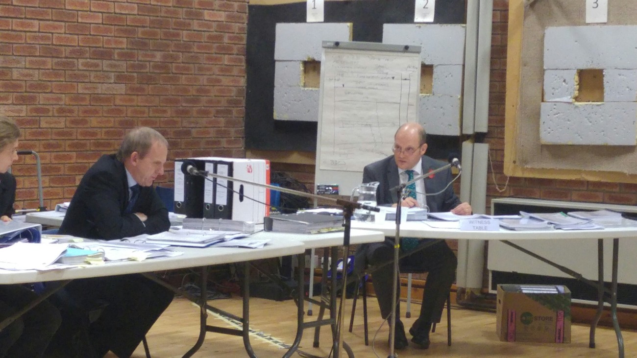
Re-examination of James Dodds

Richard Glover, for Egdon Resources, and Managing Director, Mark Abbott, 10 November 2017. Photo: DrillOrDrop
Mr Dodds says mistakes in his documents make no difference to his risk assessment.
On calculations on how fast water could move through the liner, he says the liner is protecting land underneath and allowing time to deal with contamination.
Richard Glover, for Egdon Resources, asks what evidence has been used to support the argument that there is a clay cap in this location. Mr Dodds refers to the great oolite formation, which he says is clay-rich, dips under the site. He points to a British Geological Survey log of a borehole near the Wressle site and a drillers’ log for the site. Mr Dodds says: “I’m starting to lose the plot a bit”.
Mr Dodds says he was not asked to do additional baseline survey work by the Environment Agency or the council.
Mr Glover refers to an earlier question from the public about the location of the Brigg Fault. Mr Dodds says there is no evidence that faulting is significant for the risk assessment.
Mr Glover asks Mr Dodds whether the Environment Agency relies only on the information from an applicant. Mr Dodds says the agency has access to its own data and has built local knowledge.
12.49am Egdon Resources case
Questions to James Dodds from the inspector
The inspector, Keri Williams, asks about the protection for the liner. Mr Dodds says the geotextile layers will protect the liner from damage. Mr Dodds says a site investigation – not carried out before installing the liner – would have been helpful. He says:
“With hindsight and the information about the sand under the site I don’t think it would change anything. It might be worth doing a site investigation. I would be very surprised if it came up with anything unusual.”
Asked about private water supplies, Mr Dodds says they have been properly assessed because they have been identified.
On contamination problems, Mr Dodds says you would know where this would have happened and it would be manageable. I’m not saying it would be easy or cheap.
12.30am Egdon Resources case
Questions to James Dodds from members of the public
Faulting and aquifers
Andrew McLeod asks Mr Dodds about the reference in the Elliott hdyrogeology reports, sent to the planning committee, that the principal aquifer is isolated from the reservoir by a fault. Mr Dodds says
“To be perfectly honest with you I don’t know what he means”.
Mr McLeod says the map shows a fault isolating the aquifer. “I don’t think so”, Mr Dodds says.
Mr Dodds says faulting is no form of mitigation. There are principal aquifers below the site. There are faults in the area. There has to be movement within the system.
Mr McLeod asks whether that statement is correct. Mr Dodds says the principal aquifers have been risk-assessed. The presence of faults has not come into mitigation.
Mr McLeod says the only fault mentioned is the Brigg Fault. Yesterday that 3D survey material did not show the fault. This was available in 2012. So this information, given to the planning committee, was incorrect. Mr Dodds says there is no material fault. Mr McLeod says the crux of this appeal is that the information was inadequate. That information on the fault was given to the planning committee even though it was inaccurate.
In a response to Jean Turner, Mr Dodds says the Envireau Water report was provided to the Environment Agency as part of the permit application, as well as to North Lincolnshire Council for the second planning application.
Mr Dodds is asked whether his company would be monitoring at Wressle-1. He says it isn’t monitoring at present. He is asked whether his firm is monitoring at KM8 in North Yorkshire. Mr Dodds says he is involved in that site monitoring. He is asked if he is aware of criticism of the quality of monitoring KM8. Mr Dodds says his company is highly experienced in groundwater monitoring. I have every confidence that Envireau Water is capable of monitoring at Wressle-1 if it were asked.
11.25am Egdon Resources case
Continued cross-examination of James Dodds
Groundwater monitoring boreholes
Alan Evans, for North Lincolnshire Council, questions Mr Dodds about the groundwater monitoring boreholes.
Mr Evans points out that Borehole 2 has a change marked in the schematic geology but not in the drillers’ logs. Mr Dodds accepts that the two do not correspond. Has this been corrected?, Mr Evans asks. Mr Dodds says they were in the Envireau Water report, which went to the Environment Agency.
There is nothing in the borehole records that could be interpreted as Kellaway clay, Mr Evans asks. Mr Dodds agrees.
The drillers’ records show there is no capping layer of Kellaway clay, Mr Evans suggests. Mr Dodds agrees.
Mr Evans says reliance was being put on the Kellaway clay by Egdon but the drillers’ logs don’t show this. Mr Dodds agrees that the shallow boreholes don’t show clay.
Mr Evans says the rotary drilling produces a grey mush which makes interpretation more difficult. Mr Dodds says the drillers’ logs record what comes back from the drilling. Clay comes back as a slurry. Hard rocks come back as chipping. The drillers record the vibration and speed of progress of the borehole because that indicates the hardness of material, Mr Dodds says. The exclusion of information is also useful, he adds.
Mr Evans asks again whether interpretation is more difficult from rotary drilling, than coring.
You weren’t there when this was being done?, Mr Evans asks. Mr Dodds agrees.
No permeabiliity testing was carried out?, Mr Evans asks. No, Mr Dodds says. He confirms that no hydrogeoligst was on site. A hydrogeologist would have considered the texture and colour of the returns from the borehole, he says.
Egdon’s argument for a capping layer
Egdon argues there is a capping layer on the site because there was formerly artesian conditions, an area of confined groundwater under pressure.
Mr Dodds says there would be a range of definitions of artesian conditions. But he says:
“In order to generate confinement, you have to have a seal on top of the aquifer, and for a sufficient seal that has to be practically impermeable.”
North Lincolnshire Council has submitted an alternative definition, The council says you don’t necessarily need an impermeable covering at the top or bottom – a low permeability layer may be enough to confine water at a higher pressure. A contrast is enough to create the conditions.
Mr Evans asks whether there have been an calculations or detailed analysis of Egdon’s theoretical argument. Mr Dodds says they have not been any calculations. He says there is evidence at the Wressle site for a 20m head of water in the past and this would require a cap layer.
Risk assessments
Mr Evans says the Elliott report screeens out the Lincolnshire Limestone from any risk because of a capping layer and artestian pressure. This stands and falls on whether artestian pressure (which doesn’t exist)and a capping layer (which may not exist). If the inspector does not accept these are present then it would be wrong to screen out the Lincolnshire Limestone, Mr Evans asks. Mr Dodds agrees.
The Envireau Water report also screens out the Lincolnshire Limestone from risk for the same reasons, Mr Evans says.
Mr Evans puts it to Mr Dodds that the Lincolnshire Limestone should be screened in to the risk assessment, not screened out. M Dodds says it should be screened out because of a low permeability cap. He accepts it should be screened in if the low permeability cap is wrong.
Mr Evans says the British Steel borehole at Clapgate takes water from the Great Oolite formation, as well as the Lincolnshire Limestone formation. Mr Dodds says if water is in the Great Oolite it would be able to flow into the British Steel borehole.
Shouldn’t this be risk assessed if there is potential for this water to reach the borehole, Mr Evans asks. Mr Dodds says the Great Oolite has been identified as a receptor in the Envireau Water report.
Mr Evans says the Envireau Water report screened out the Great Oolite from the risk assessment. Mr Dodds says this is because of the capping layer (see above and artesian conditions below).
Baseline data
Mr Evans says the detail of baseline data is a matter of judgement. Mr Dodds agrees this is the starting point.
Mr Evans asks if Envireau Water are involved in the baseline data application. There was a more detailed level of baseline research with contact with people by email and post. Mr Dodds agrees. He says there are scientific and political reasons for doing work above and beyond what is necessary. Mr Dodds says:
“It is entirely wrong to infer anything that was done or not done in the Vale of Pickering.”
Conceptual models
Mr Evans suggests that there should be a conceptual model in a risk assessment.
“There is nothing that would pass muster as conceptual models in the Elliott reports?”
Mr Dodds agrees. It doesn’t mean to say he hasn’t considered this issues, he says.
Mr Evans puts it to Mr Dodds: “We don’t think you [in the Envireau Water report] made a conceptual model”.
The Envireau Water model lacks detail at the shallower geology, Mr Evans says.
Mr Dodds says the conceptual model informs the risk assessment. They explain the geological sequence for the Wressle-1 well. It focuses on the shallow section, he says.
A conceptual hydrogeological model has not been presented, Mr Dodds says. The detail is is in the text, which is appropriate to the risks. No hazards or receptors have been missed, he says.
Groundwater monitoring boreholes
Mr Evans puts it to Mr Dodds that a large section of the site, including the boundary with the Ella Beck, that is not covered by the boreholes. Mr Dodds agrees that the northern side of the site is not monitored by the boreholes.
That could have been avoided if there had been suitably qualified staff on the site and the boreholes would have been drilled to an appropriate depth. Mr Dodds agrees.
Mr Evans says there could be a dense contaminant that lies below the superficial boreholes. Mr Dodds says that trace could be picked up in the boreholes. This is second best, Mr Evans suggests. The best thing would be to have boreholes that went to an appropriate depth. Mr Dodds agrees.
You can’t tell from a trace the significance of a pollution incidence. Mr Dodds says the monitoring doesn’t sit in isolation and is part on overall management system. He says the mitigation assumes there will not be contamination because it will have been caught by the liner.
It would be better to look in the place where it is more likely to be, Mr Evans suggests. You should be looking there in a deeper borehole. I don’t disagree, Mr Dodds says.
Mr Dodds says if your analysis suggests there is contamination you would monitor in the appropriate way.
11.05am Break
The inquiry resumes at 11.25am
10.23am Egdon Resources case
Cross-examination of James Dodds
Mr Dodds (right) cross-examined by Alan Evans (left), 10 November 2017. Photo: DrillOrDrop
Errors
Alan Evans asks Mr Dodds about the mistakes in his witness statement and a page of corrections. Mr Dodds incorrectly said there were 600mm of stone (instead of 300mm) and 50mm of sand (instead of geotextile) on top of the liner. Mr Dodds says he can’t find the source of the errors. Mr Evans says:
“That’s got the hallmarks of carelessness. Do you accept that?”
Mr Dodds say typographically errors occur in documents. Mr Evans says “sand” is not a typographical.
Calculations on permeability of the liner
Mr Evans raises the issue of leaks through the liner. Have you done any calculations of what could get through this liner on a short term basis?
“There have been no calculations, no”
There are no calculations of what could get through the liner, Mr Dodds confirmed.
Mistakenly claimed Artesian conditions
Mr Dodds says the sealing effect of geology continues but the artesian conditions no longer exist. He confirms that the hydraulic gradient below the site has changed.
Mr Evans refers to a report by R Elliott, submitted with the January application for Egdon. This report suggested that the artesian conditions remained and that the cap may be fractured.
“We now know that is wrong because there are not artesian conditions there”, Mr Evans says
“Since then the [groundwater] observation boreholes were drilled and they demonstrated that this report is incorrect”, Mr Dodds says.
Mr Evans asks what was the evidence for making the statement in the first place. Mr Dodds says he doesn’t know. “It is unevidenced and it was proved wrong”, Mr Dodds says.
Mr Evans says the claim of artesian conditions was still being made for by Mr Elliott in Egdon in May 2017, after the groundwater boreholes had been dug. Mr Evans says:
“That’s careless. He’s got that wrong. He hasn’t taken account of further evidence available at that time. He shouldn’t have got it wrong because there was evidence available.”
He’s an highly experienced engineer but he’s not an experienced hydrogeologist, Mr Dodds says.
Mr Evans says:
“He’s the author of the report put before the planning committee on hydrogeology, water management and pollution. Are you saying he’s less than experienced?
Mr Dodds says Mr Elliott may have a team of hydrogeologists behind him.
Incorrect statement on hydraulic gradient
Mr Evans refers to a report by Envireau Water, overseen by Mr Dodds and his company. This says there is a moderate risk of spillage, leaching and infilltration from the surface. But the risk of this reaching the aquifer is low because of an upward hydraulic gradient which prevents downward movement of water.
“That’s not correct, is it?”, Mr Evans asks.
Mr Dodds admits this is an error.
Protection for Lincolnshire Limestone
Mr Evans asks what evidence was being relied on by Egdon when it said in one of the Elliot reports that the Lincolnshire Limestone aquifer was protected from spills at the surface. Mr Dodds says it was the Kellaways Formation. Mr Evans asks if this the Kellaways clay (not the Kellaways sand). Indeed, Mr Dodds says.
Mr Evans says a geology map shows that half the site is not underlain by the Kellaways formation at all.
The Kellaways formation could not form as a cap for the whole site, Mr Evans says. Mr Dodds agrees.
Monitoring borehole construction
Mr Evans says the borehole logs show evidence of the Kellaways formation in the base of three boreholes.
The intention was to log the material drilled from the water monitoring borehole to Eurocode 7, a recognised European standard, Mr Evans says. The method of drilling then made it inappropriate to log to that standard. Mr Dodds says this logging would be impossible.
9.38am Egdon Resources case
Continuing evidence from James Dodds, hydrogeology and water management consultant, Envireau Water

James Dodds, 9 November 2017. Photo: DrillOrDrop
Mr Dodds says the Wressle site has been designed to be sealed. It contains rainfall, to a volume up to a 1:100 year event, and releases water to the environment when safe to do so. In a water quality problem, the site can be isolated. This protects the environment from uncontrolled discharge, he says.
Risk assessment
The key risks are to shallow groundwater and surface water, he says. Risk assessments have been carried out following accepted procedures. The mitigated risk is very low or negligible, he says.
Baseline studies on ground and surface water were robust, he says. Richard Glover, for Egdon Resources, asks whether further information would have made any difference to the conclusions. Mr Dodds says:
“One wouldn’t look to the ends of the earth for data. One would restrict the search to the scale of the development.”
He says the search for groundwater information would use Environment Agency, British Geological Survey and private databases. This would show where water was being extracted. It was what happened in this case in the baseline studies, he says.
Susan Wagstaff, for North Lincolnshire Council, had suggested door-door studies should have been carried out. Mr Dodds says these surveys are rare, apart from proposals where water would abstracted. In this case because the risk assessment comes out with “no risk” there is not requirement to do this sort of survey, he says.
There was sufficient baseline assessment of any receptors to risk, he says.
“As long as the pathways and the receptors have been identified then the mitigation will protect and the mitigated risk is reduced to practically nothing.”
Site design and mitigation of risk
The potential risk to the water environment comes from accidental spill of liquids, Mr Dodds says. The site includes embedded mitigation measures including: earth bunds; bentomat impermeable membrane; interceptor to prevent uncontrolled release of surface water; casings to the well. Clay geology also produces a seal.
Mr Glover says the council is concerned about the bentomat liner, which could leak, leading to potential pollution. He asks Mr Dodds how likely this would be.
Mr Dodds says any liner has a finite permeability. But he says the permeability is very low. There are several barriers to leaks on the site, he says. Liquids are held in tanks and surrounded by a bunded areas. The bentomat is the third barrier.
He says the site in production would be staffed 24-hours. In normal operations there will be someone doing inspections every day and two people involved in tankering. The spill will move extremely slow through the liner.
“You are talking months, many months, before anything would go through that liner”
Remedial action would be taken immediately, he says. It would be cleaned up – or if it had moved into the gravel layer the leak and gravel would be bagged up. The operation would take minutes.
Mr Dodds says he doesn’t agree with the council’s case that groundwater monitoring boreholes would not pick up some hydrocarbon spills. He says any hydrocarbon spill will dissolve in the water, leaving a trace that is detectable in the monitoring boreholes. As water is taken from the borehole, any pollutant will also fall.
Mr Dodds says no statutory consultee objected to Egdon’s proposals on groundwater issues. British Steel withdrew its objection to the second application.
All the work done on the Wressle well will be done at 1,600m. This is separated by 700m from aquifers. The water management proposed means the site is self-contained and hydrologically isolated from any spills or problems. This, together with adequate storage, mitigates any uncontrolled spills. Mitigated risks are very low or negligible, he says.
The risk assessments clearly shows that the site construction civil works do not a pose a significant risk to the water environment. Operations for oil and gas production (proppant squeeze, acidisation, radial drilling or side-track drilling) do not pose a significant risk to the water environment, he adds.
“It is my opinion that sufficient information was supplied to satisfy the planning authority for both the first and second applications.”
Detail on the site construction was adequate, he says. The level of information is appropriate level of risk.
“I do not agree with North Lincolnshire Council that is is insufficient information or any material risk to local residents, community or the local economy.”
9.32am Egdon Resources case
Extra information
Richard Glover, for Egdon Resources, submits extra documents. In response to issues raised on previous days. He says the Environment Agency would approve the installation and design of the interceptor. In answer to a question by Kathryn McWhirter, he says the permeablility of the oil formation is 55 millidarcies.
9.30am Inquiry opens
This report has been made possible by donations from individual DrillOrDrop readers
Categories: Regulation


‘All the work done on the Wressle well will be done at 1,600m. This is separated by 700m from aquifers.’ (Dodds) And connected by the well bore with its possibly dodgy cement. (Me) One day that wellbore’s lining will corrode and crumble. All that hydrofluoric and hydrochloric acid +++ and all that fracking won’t help maintain its integrity! Anbd what about that BB fault? Egdon seemed a little unsure about whetehr they had intersected it or not? Maybe they addressed that on day 4, I am still reading….