Back to Southwest map
Please let us know if any of the information is missing or wrong Contact

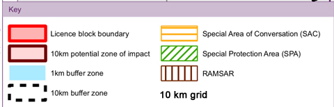
Map credit: DECC Habitats Regulations Assessments of 14th Onshore Oil and Gas Licencing Round amended to follow England/Wales border
(Maps are in the Appendix E link at the bottom of the DECC page)
14 September 2016: South Western announce they will not accept the licence for this block. DrillOrDrop report
SO50a No current licence operator
This block was initially offered to:
Licence Operator South Western
Partner South Western Energy Limited
Other blocks in licence SO51a
Licence type Coal Bed Methane
Commitments None
Drill Or Drop clause 1 well
The licence in this area covers several blocks, including this one. The listed commitments are for the whole licence area, not per block.
Administrative areas covered by licence
Gloucestershire
Wales
Parliamentary constituencies and MPs
Forest of Dean Mark Harper Conservative
Monmouth David Davies Conservative
European areas overlapping with licence block
Wye Valley and Forest of Dean Bat Sites SAC
Wye Valley Woodlands SAC
River Wye SAC
European areas outside block which could be adversely affected
Severn Estuary SAC
Severn Estuary SPA
Severn Estuary RAMSAR
Wildlife Trust sites overlapping with block
East Wood (Gloucestershire Wildlife Trust)
Lippets Grove (Gloucestershire Wildlife Trust)
Sensitivity concerns Bats, Birds, Coastal habitat, Rivers, Otters, Vibration effects from nearby drilling
Conditions
Stage A, B, C and D activities will be prohibited at or near to the surface within the boundaries of all European sites in this block.
Advice
This block has European sites within it, or within 1km of the block boundary. In general, land within approximately
1km of a European site is considered to be of a potentially sensitive nature (due to its proximity to the European site) such that mitigation and/or alternative siting may be required by authorities further considering HRA issues for specific project-level operations. .- In some instances, bird species that are associated with SPAs and some Ramsar sites may rely on non-designated habitats beyond the European site boundaries, and so could be vulnerable to activities occurring outside the designated site itself. Land within 10kmof an SPA, or a Ramsar site designated for its bird populations, is therefore considered to be of a potentially sensitive nature (due to its proximity to the European site) such that mitigation and/or alternative siting may be required by authorities further considering HRA issues for specific project-level operations. The European sites potentially vulnerable in or near this block are Severn Estuary Ramsar, Severn Estuary SPA.- Coastal or marine habitat features could be vulnerable to any changes in coastal processes that occur due to activities occurring along the coastline. Land located along the coastline (i.e. within 1km of the mean low water level), and which is also within 10km of a European site with coastal habitats, is therefore considered to be of a potentially sensitive nature (due to its potential connectivity to a European site) such that mitigation and/or alternative siting may be required by authorities further considering HRA issues for specific project-level operations. The European sites potentially vulnerable in or near this block are Severn Estuary Ramsar, Severn Estuary/Môr Hafren SAC.- Riparian or estuarine habitats and species may be sensitive to impacts on tributary watercourses by activities. Land that is within 10km of a riparian or estuarine European site, and which is also within 200 metres of a contributory watercourse to that site, is considered to be of a potentially sensitive nature (due to its potential connectivity to a European site) such that mitigation and/or alternative siting may be required by authorities further considering HRA issues for specific project-level operations. The European sites potentially vulnerable in or near this block are River Wye/ Afon Gwy SAC.- Otters (Lutra lutra) travel along rivers and their tributaries, and occasionally use semi-natural habitats beyond the riparian corridor, and so could be vulnerable to activities occurring outside the designated site itself. Land that is within 10km of a site supporting otters, and which is also within 200 metres of a contributory watercourse to that site, is considered to be of a potentially sensitive nature (due to its potential to be used by otters) such that mitigation and/or alternative siting may be required by authorities further considering HRA issues for specific project-level operations. The European sites potentially vulnerable in or near this block are River Wye/ Afon Gwy SAC.- Bat species usually rely on non-designated habitats beyond the European site boundaries (bats can commute and forage for many kilometres beyond their core habitat), and so could be vulnerable to activities occurring outside the designated site itself. Land withinthe 10km of an SAC designated for its bat populations is considered to be of a potentially sensitive nature (due to its proximity to the European site) such that mitigation and/or alternative siting may be required by authorities further considering HRA issues for specific project-level operations. The European sites potentially vulnerable in or near this block are Wye Valley Woodlands/ Coetiroedd Dyffryn Gwy SAC, Wye Valley and Forest of Dean Bat Sites/ Safleoedd Ystlumod Dyffryn Gwy a Fforest y Ddena SAC.- Some of European site interest features (e.g. birds species; fish; marine mammals) are potentially sensitive to noise or vibration effects associated with Stage A activities (as well as Stage B, C and D activities). Land within approximately 1km of a European site supporting noise or vibration sensitive features is considered to be of a potentially sensitive nature (due to its proximity to the European site) such that mitigation and/or alternative siting may be required by authorities further considering HRA issues for specific project-level operations. The European sites with features potentially vulnerable to this in or near this block are Severn Estuary Ramsar, Severn Estuary SPA, River Wye/ Afon Gwy SAC, Severn Estuary/Môr Hafren SAC.


2 replies »