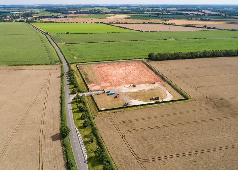
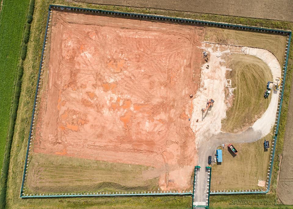
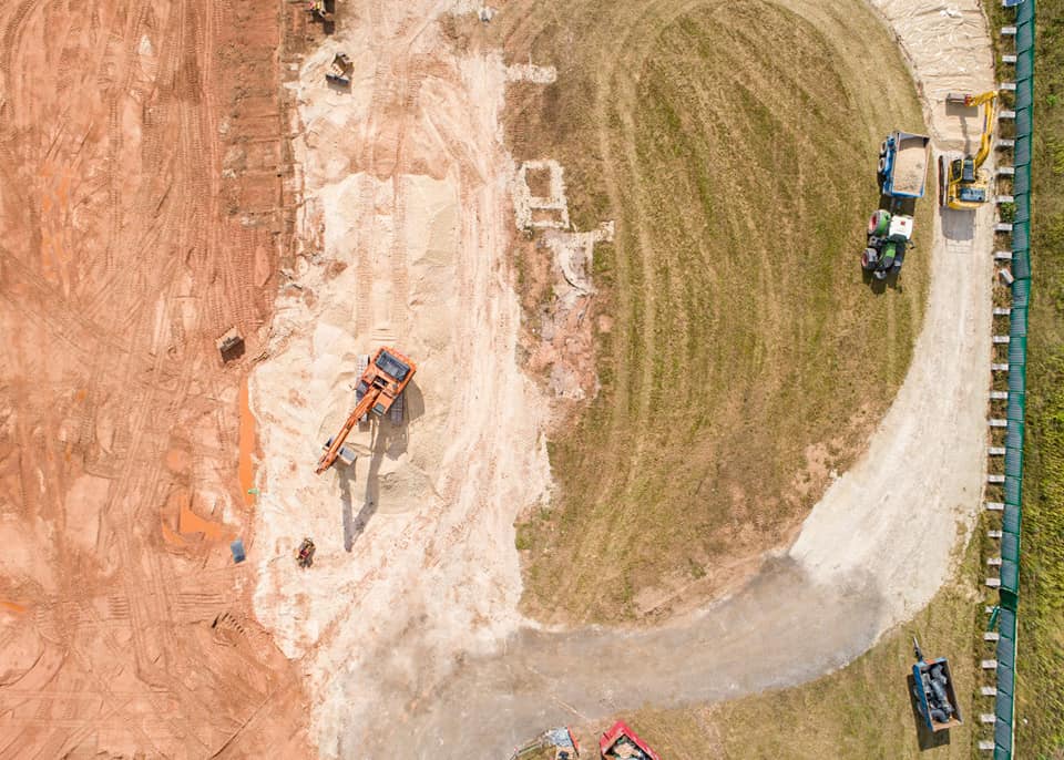
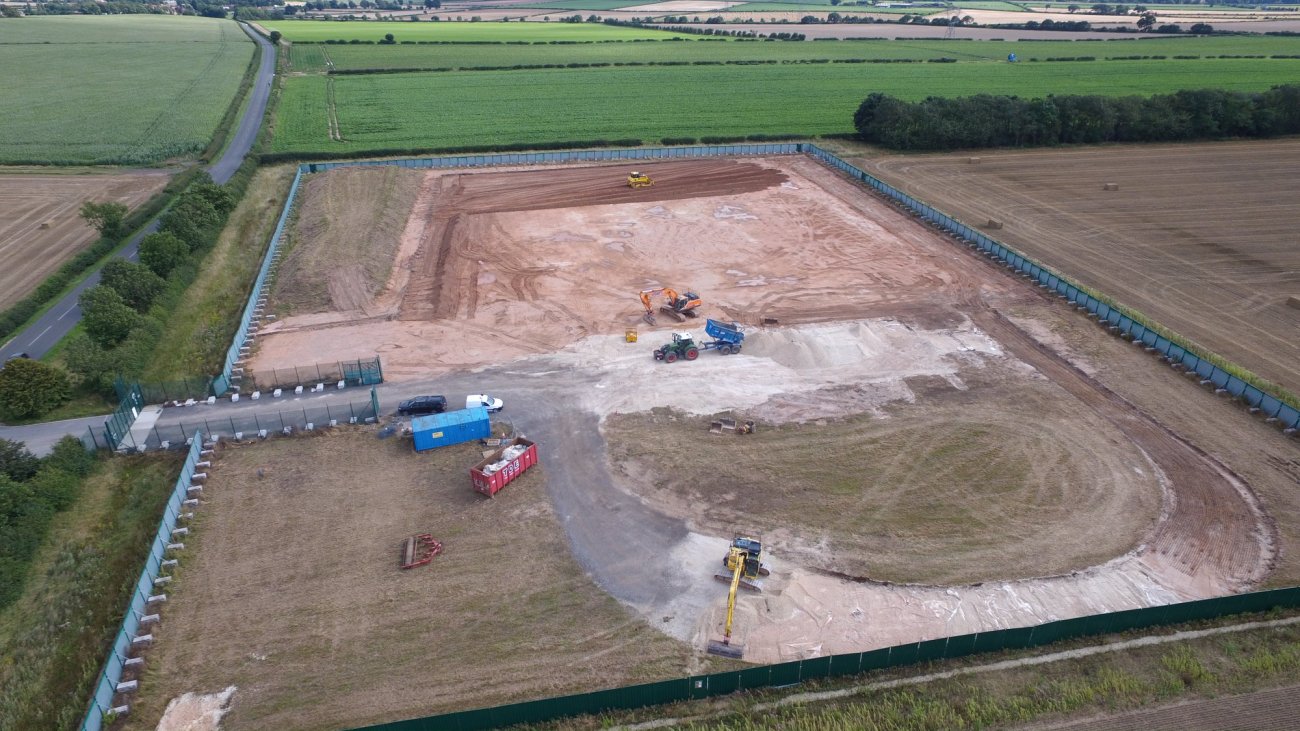
Eric Walton has been photographing the IGas shale gas site at Tinker Lane in north Nottinghamshire since construction work began in spring 2018.
The vertical well, drilled in November 2018, failed to encounter the target Bowland shale.
In February 2018, IGas reported that the well had been plugged and abandoned.
On 10 July 2019, the company confirmed that work was underway to restore the site to farmland.

Demolition equipment at the Tinker Lane site, 10 July 2019. Photo: Used with the owner’s consent
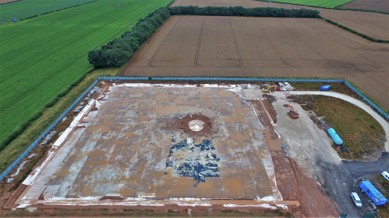
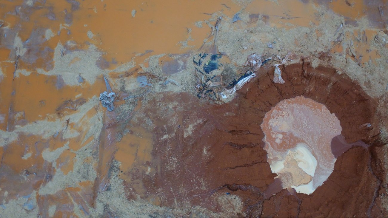
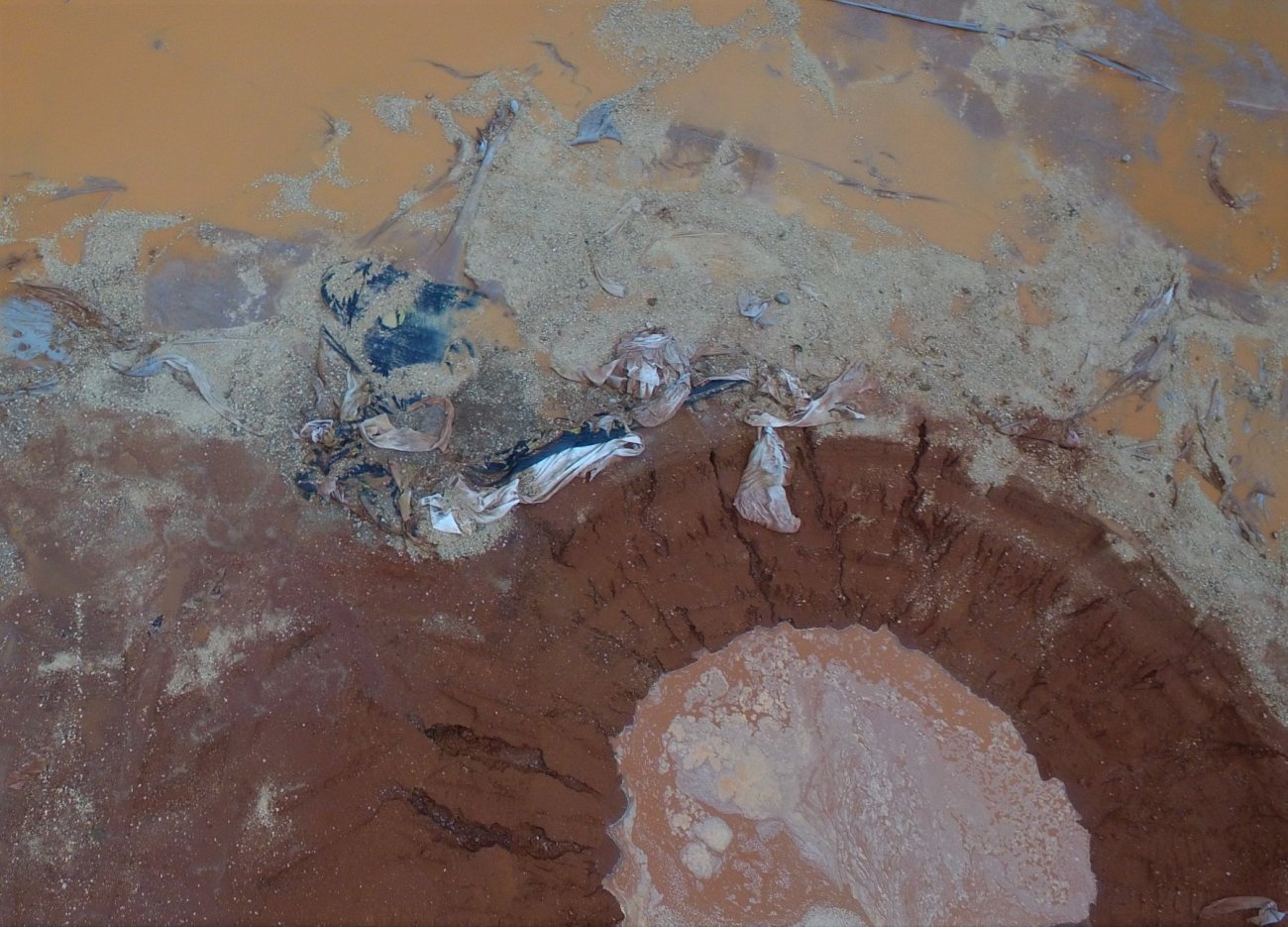
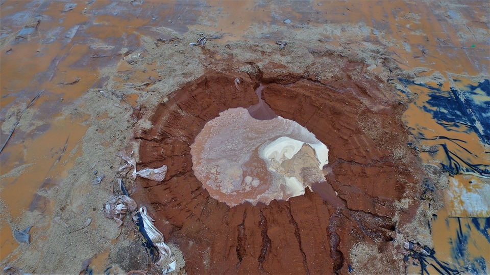
In this post, Eric Walton’s images record the restoration work a Tinker Lane. The images from 31 July 2019 raised concerns, among some opponents of shale gas exploration, about the state of the site liner.
31 July 2019


9 August 2019


12 August 2019


DrillOrDrop key facts and timeline for Tinker Lane
DrillOrDrop page of pictures from the development of Tinker Lane
Categories: Industry


Does Eric Walton have a permission notice?
Permission for what?
Recording history in the making is a duty, not a crime.
[Image removed due to copyright concerns]
Eli-Goth,
What’s it got to do with you?
[Edited by moderator] Anybody seen the Forbes report on their budget for anti-renewable lobbying? Top two outfits between them spend over $100 million per annum! [Edited by moderator]
Peter K
Which Forbes report, there are quite a few?
https://www.forbes.com/sites/rrapier/2019/07/14/ten-countries-that-dominate-fossil-fuel-production/#796625f65b13
Looks good. Did a good job scraping the stone off the liner it seems.
Plus, on the first 12th August picture, good they got the harvest in, but off to the grain dryer I suspect as it has been a bit wet.
But the irrigation reel is still out there just in case for the spuds?
Still looks a mess to me. Just another reason against fracking.
Land just cannot be returned to its previous state
Christine Ford
They have yet to complete the restoration.
There are plenty of restored sites in Notts, which you would only know about if you have an old 2.5 inch to the mile map … with them marked on it. Some are in fields, others have been left to nature ( and are doing fine ).
[Image removed due to copyright concerns]
Christine
Sorry, that link is to many pictures, but it is the first I refer to.
I would prefer the site is used for either a return to nature ( ie..truly restored ..leave nature to its self )
Or pop in a concrete base for a big-wind turbine. The site has access and piling would not cause too much trouble. All ready for a relaxation in the availability of subsidy to onshore wind. A double win for the farmer and a win for the local community.
Expand on your “permission notice” comment with what you think that is, and why I would need one at all.
This should be interesting.